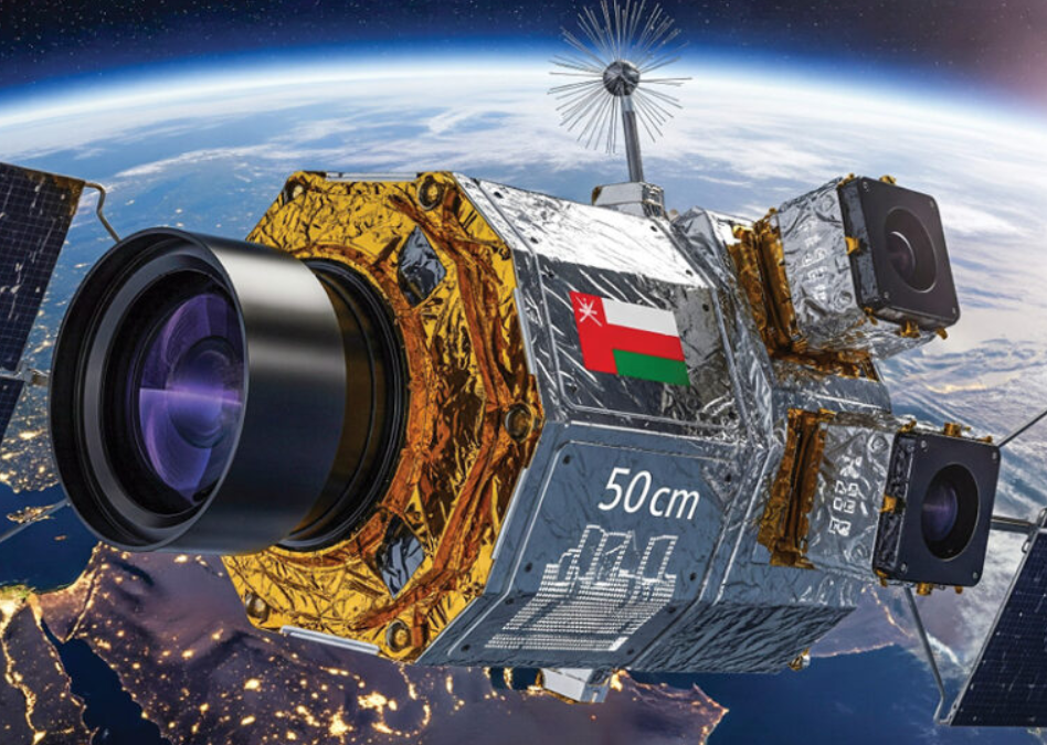
Oman today_ Oman’s homegrown space technology company, Oman Lens, has announced plans to launch an advanced satellite in the first half of 2026. The satellite will be equipped with a high-resolution 50cm panchromatic camera, multispectral RGB and near-infrared (NIR) sensors, and an artificial intelligence platform capable of performing over 400 trillion operations per second.
Designed for Earth observation and remote sensing, the satellite will support applications such as flood prediction and management, urban planning, road development, and monitoring of vegetation and the environment. This new project builds on the experience of Oman Lens’ first satellite, OL1, which was launched in November 2024 and provided 1-meter resolution imagery. By combining artificial intelligence with high-resolution data, the new satellite will enable more precise monitoring of environmental and urban developments.
In collaboration with Star Vision Space and the Bahrain Space Agency, the project incorporates a specialized on-board processing algorithm that distinguishes between cloud cover and the Earth’s surface, improving the accuracy of natural resource management and environmental monitoring across the Middle East and North Africa.
Oman Lens has also signed agreements with several partners for this project, including Oman Chromite, Ankaa Space and Technologies, Mustafa Sultan Telecommunications, GIS HUB, and Bedrock Mineral Resource Consulting.
This initiative aligns with Oman Vision 2040 and aims to strengthen the sultanate’s position as a regional hub for space technology and AI-driven solutions, promoting innovation and sustainable development nationwide.
Oman Prepares to Launch Advanced AI-Powered Satellite in 2026